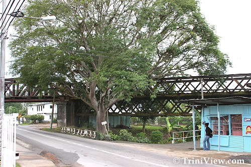
 Red Bridge on Southern Main Road, Point-A-Pierre
TriniView.com Staff Article
Posted: November 30, 2006
The notable Pointe-à-Pierre area was one of the first areas in Trinidad to become settled after conquest resulting from the Cedula of Population of 1783. Pointe-à-Pierre lies north of San Fernando, is situated south of Claxton Bay and is bordered by the popular Naparimas. Also, on the map of Trinidad and Tobago, it can be found on the Gulf of Paria and is separated from Marabella by the Guaracara River and from Gasparillo by the Sir Solomon Hochoy Highway. When the area was first settled after the Cedula of Population, many French settlers such as Nandillon, Le Fevre, Letain, and Pechier, just to name a few, brought with them enslaved Africans who immediately began to cultivate their lands for agricultural purposes.
But before the French were the Spanish and they were initially attracted to lands for its scenic beauty as well as its rich soils. Also, within the region of Point-a-Pierre was a coastal feature that made it very popular with the Spanish conquistadors: its headland which they referred to as "Punta de Piedras" or "Point of Stones." It was the French that translated the name to "Point-a-Pierre" and it has remained so ever since naming the entire settlement.
Pointe-à-Pierre was so popular after the French had arrived in 1783 that its population increased from 290 in 1797 to 846 in 1812; an increase of 556 in 15 years.
Pointe-à-Pierre was also a very productive area with as many as 32 estates (220 acres) administered by La Source Mandillon who was granted administrative control of the land under the terms and conditions of the Cedula of Population of 1783.
By 1797, 23 sugar mills were in existence along with some cattle, 5 steam engines and about 24 rum distilleries which were said to produce as much as 7,650 gallons of rum.
Sugar in the region became so popular that by 1817 areas such as Concorde, Bon Accord, Plein Palais and La Carriere began to compete on the local scale. The area of Concorde in Pointe-à-Pierre because of its strategic position at the mouth of the Guaracara River was the most successful of these sugar estates.
After the abolition of Slavery in 1838, the ex-enslaved Africans squatted on the Crown lands in the area which proved to be a great problem for the authorities. It was at this time that the Pointe-à-Pierre village sprang up. The adjacent Plaisance Estate, which was known for its sugar estates and sugarcane plantations also became a place popular for outings because of its natural hot springs which were believed to be therapeutic. In addition, the Pointe-à-Pierre coastline, although not noted for the finest beaches in the country, was still a relatively popular bathing spot in the 1860's and was lined with resort cottages around this time.
Pointe-à-Pierre, which was difficult to access became easily accessible when the Trinidad Government Railway passed through it in 1882 to San Fernando. In that same year, a Roman Catholic chapel was built. Church ceremonies at the time were extremely popular and a recreational activity that many looked forward to. The railway system helped to bring crowd to the church. At that time Fr. J.B Rabanit was the Parish priest, and the Archbishop Louis Gonin frequented the chapel to officiate several ceremonies.
Pointe-à-Pierre became even more popular when the Guaracara line was established which passed through the Concorde Estate to connect Princes Town with San Fernando. This made the movement of people from the South to go to Port-of-Spain or from areas close by such as from Pointe-à-Pierre to La Carriere Estate or Plein Palais Estate much easier.
The popular hot springs of the Plaisance Estate seemed to be a pull factor in luring people to the area along with the Southern Main Road Estate tracks which had several houses along the periphery. Still, the area no longer had the upward growth spurt that it had in previous years as by 1881, the population for the entire quarter was only 4,393.
By 1912, the estates of Plaisance, Bon Accord, Bonne Aventure, Plein Palais, La Carriere and Concorde were all successful sugar producing areas. However, by 1913, an oil company called Trinidad Leaseholds Limited bought all the estate lands in the area which were found to contain oil since 1857. Although at the time the oil refinery was basically a small centre and oil storage deposit, it soon grew to become one of the most important refineries in the western hemisphere.
Since then, Trinidad's oil refinery has changed hands several times. Below is a diagram showing the evolution of Trinidad and Tobago's oil refinery.
 A diagram showing the evolution of Petrotrin
(Credit: Corporate Communications Department, Petrotrin, Pointe-a-Pierre)
Today, Pointe-à-Pierre is still an overwhelmingly oil based village with many employees of the oil refinery residing in Plaissance Park. Most of the key refinery workers, especially those linked with the essential services reside in "The Camp" which formerly housed émigré personnel. In fact, within "The Camp" contains a primary school, a yacht club and a staff club equipped with a pool, tennis courts, squash courts and an 18 hole golf course.
In addition, the town is also the home of the Pointe-à-Pierre Wild Fowl Trust which is a wildlife reserve for waterfowl located within the premises of the Petrotrin oil refinery.
The region is very critical to the economy of Trinidad bringing in much of the country's annual income and employs many people in the oil industries. Although, the area is situated far south, it is still deemed one of the most significant areas of Trinidad and Tobago.
Pointe-à-Pierre in pictures:
http://triniview.com/album/Pointe-a-Pierre_221106
Pointe-à-Pierre | Homepage | Special Events | Album
|